There’s a stretch of water between King Island and Victoria that old sailors called the Eye of the Needle. It’s about eighty five kilometres wide, sitting right at the western entrance to Bass Strait. For the better part of a century, it swallowed ships whole.
King Island has more recorded shipwrecks than anywhere else in the country. More than 60 recorded shipwrecks, with some local estimates suggesting as many as 80. The lighthouses weren’t planned proactively, the many disasters that came beforehand created the need.
Why did so many ships wreck off King Island?
King Island sat right in the path of a busy shipping shortcut, and its reefs went largely uncharted for decades.
George Bass and Matthew Flinders proved Tasmania was an island when they circumnavigated Van Diemen’s Land in 1798-99. After that, ships sailing between England and the young colonies had a choice to make. Circumnavigate Tasmania, or cut through the strait and save the best part of a week.
Most captains took the shortcut and fair enough, time was money and a week is a week.
Following major wrecks such as the Neva in 1835, the British Admiralty expanded survey work in Bass Strait. HMS Beagle was among the vessels involved in charting the waters around King Island.
In calm weather, a careful captain could thread through without much drama. In a storm, blown off course and unsure of his position, he had no warning that land was close.
On cloudy days, captains could not always get a navigational fix using the instruments of the time. They had to rely on dead reckoning instead. Over long distances, small errors could become fatal.
By 1845, the island was still virtually uninhabited and there wasn’t a single light anywhere on its coast.
What was the Cataraqui disaster?
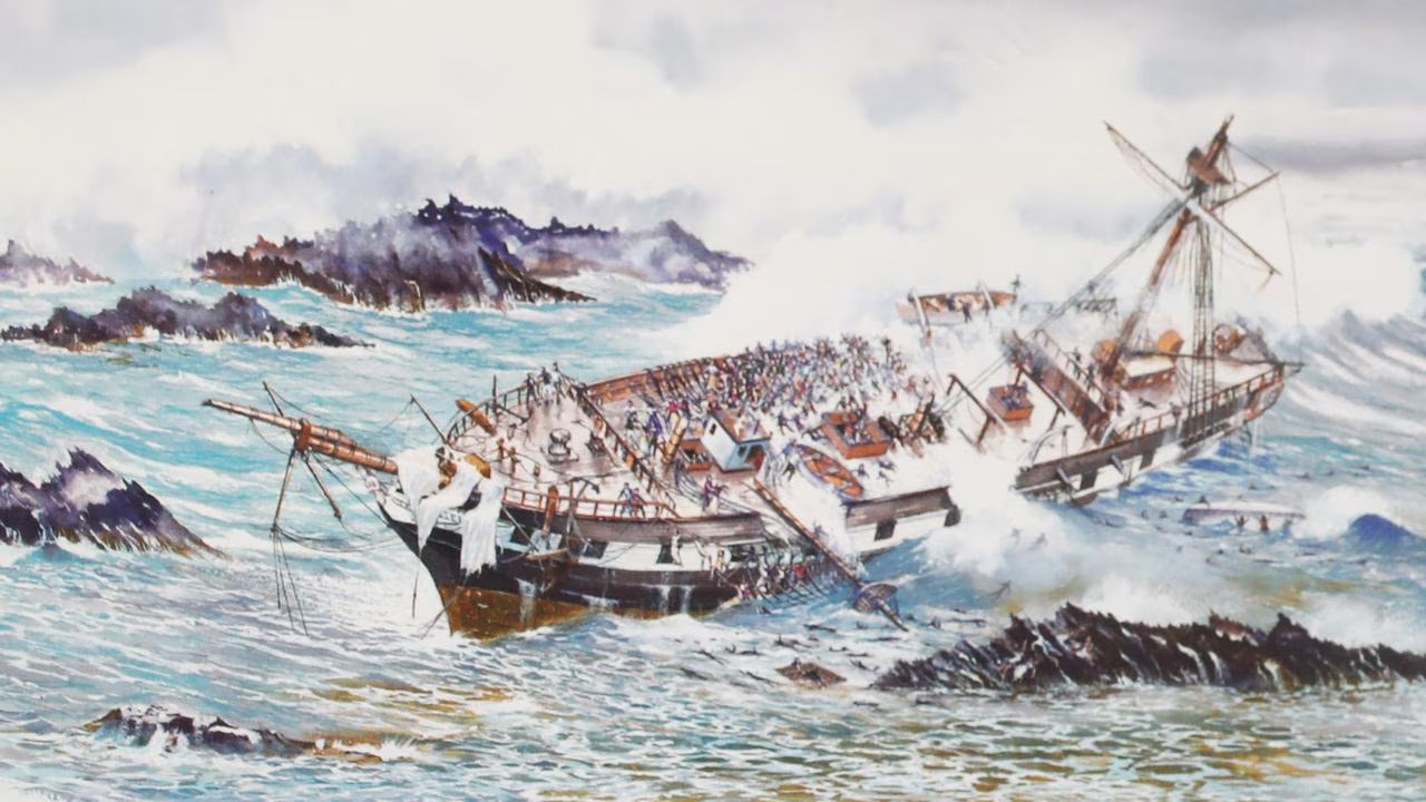
The Cataraqui was an emigrant ship. It wrecked off King Island in 1845. About 400 people died, with only nine survivors.
The Cataraqui set sail from Liverpool in April 1845, bound for Melbourne with hundreds of assisted emigrants on board. Many were families chasing a fresh start in the colony.
A fortnight of brutal weather in the Southern Ocean pushed the ship far further east than her captain realised. In the dark hours of 4 August, the Cataraqui struck a reef on King Island’s west coast. It happened less than a hundred metres from the beach.
It remains Australia’s worst civil maritime disaster. It happened on a coastline with no lighthouse and no settlement. Nobody even knew anyone needed help. Days later, a former convict, out bartering animal skins, spotted wreckage in the water and found the survivors.
The British Admiralty banned ships from using Bass Strait the following year. It lifted the ban only once a lighthouse went up at Cape Otway on the mainland in 1848. But the matching gap on the King Island side stayed dark for another thirteen years.
When was Cape Wickham Lighthouse built?
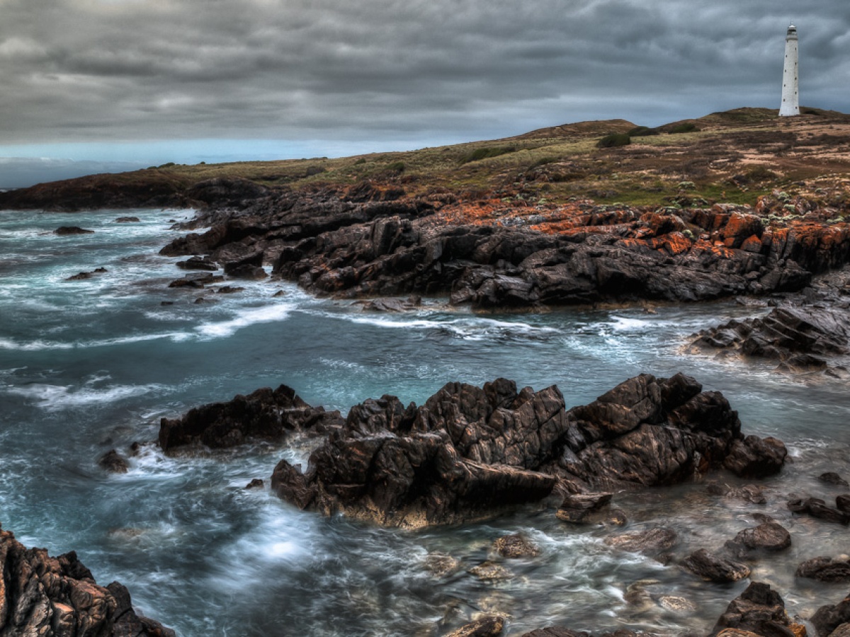
Cape Wickham Lighthouse switched on in 1861, sixteen years after the Cataraqui sank.
Talk of building it started almost immediately after the disaster, but the project took over a decade to get moving. Built from local granite and standing 48 metres tall, it’s still the tallest lighthouse in Australia and the Southern Hemisphere.
Here’s a bit of King Island trivia for you. Cape Wickham never actually had a proper opening ceremony. Nobody got around to it and the oversight wasn’t rectified until 2011. That’s when Governor-General Quentin Bryce visited for the 150th anniversary celebrations and cut the ribbon, a mere 150 years late.
We’ve never been ones to rush things, but even by King Island standards, that’s taking your time.
Why does King Island have two lighthouses?
King Island needed a second lighthouse for one simple reason. Ships kept mistaking Cape Wickham’s light for the one at Cape Otway, on the far side of Bass Strait. Instead of steering away from the island, they steered straight toward it.
The Arrow went down in 1865 and the Netherby followed in 1866, a three-masted clipper that got lost in fog three months into her voyage from London. Remarkably, every single person aboard, all 451 of them, made it to shore alive. Others through the 1870s weren’t so lucky.
The pattern was clear enough. One light fixed in place wasn’t going to cut it. Two capes sat on either side of the strait. From a distance, they looked too similar.
How is Currie Lighthouse different from Cape Wickham?

Currie Lighthouse flashes its light, while Cape Wickham’s stays fixed, so sailors can finally tell the two apart.
In 1879, a second lighthouse went up at Currie, on the island’s west coast. Chance Brothers prefabricated it in England and shipped it out in pieces, 312 of them. Workers assembled it on site as a slender iron tower on screw-pile foundations. It started operating in 1880.
A captain glancing at the horizon could finally tell which light was which, and which way to steer. Engineers positioned it to stay visible to ships coming from the south-west. It also stayed in view long enough for Cape Wickham’s light to appear too, closing the gap between them.
Lighthouse keeper William Hickmott reckoned sailors welcomed no lights in Australian waters more than King Island’s two. After everything that happened before they existed, it’s hard to argue with him.
Can you visit King Island’s lighthouses today?
You can visit both lighthouses, but only one of them you can actually go inside. Cape Wickham’s grounds are open year-round for photos and coastal views. But its tower stays closed to the public, with no climbing tours available. Currie Lighthouse is different. You can climb its 93-step spiral staircase right to the top. The only way in is through a guided tour with King Island Walks.
Cape Wickham lost its full-time keepers in the 1920s and Currie’s light went dark altogether in 1989, before locals fought to reignite it in 1995.
Cape Wickham’s original lens, a beautiful piece of glasswork, now lives down the road in the King Island Historical Museum. Fittingly, the museum occupies the old Currie lighthouse keeper’s cottage.
You can still drive right up to Cape Wickham today, alongside the golf course that now shares its name. From there, you can look out over the water that claimed so many ships before the light went up. It’s a properly wild spot. It’s also one of the few places on the island where you really feel how exposed this place always was.
There’s technically a third light too. Stokes Point, on the island’s southern tip, is a modern unmanned beacon. It guides ships through the passage to Tasmania, rather than Bass Strait itself. It’s never had a keeper, and like Cape Wickham, you can visit the grounds but not climb the tower.
Two lighthouses, built more than a century apart, for exactly the same reason. It’s a quiet kind of monument, but then, King Island has never been one for fuss.
Frequently Asked Questions
King Island has more recorded shipwrecks than anywhere else in Australia, over sixty of them. Sailors once called the passage the Eye of the Needle.
The Cataraqui was an emigrant ship that wrecked off King Island in 1845. It remains Australia’s worst civil maritime disaster, with around 400 lives lost.
Cape Wickham Lighthouse switched on in 1861. Currie Lighthouse followed in 1880, after ships kept mistaking Cape Wickham’s light for the one at Cape Otway.
Yes, though you can only climb inside Currie Lighthouse, and only through a guided King Island Walks tour. Cape Wickham’s grounds are open year-round, but its tower stays closed to the public.
Yes, Stokes Point Lighthouse sits on the island’s southern tip. It’s a modern, unmanned light that guides ships through the passage to Tasmania. The tower isn’t open to the public.